Deploying your Contrail solution in OneRain’s cloud-based managed program frees up your I.T. resources and eliminates your need to purchase and maintain servers in house. Contrail Server is updated continuously for maximum performance and security. OneRain manages and administers server OS and security updates, and performs all Contrail software application updates and new releases. We are committed to providing the highest level of service. Each one of our client’s Contrail Server cloud-deployments is monitored by our team around-the-clock 24/7/365 to ensure your data feeds and data collection processes are properly operating, and that you have access to our solutions when you need to.
Highlights
-
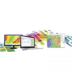
- Brings all your water, rainfall and weather-related environmental data together in one place.
- Seamless integration and automated data collection from many sensor types and multiple sources (ALERT/ALERT2, USGS, METAR, RAWS, HADS, CDEC, Tides, GoData, RWIS, SCADA, Modbus and more…)
- Supports many users with no special software to install anywhere except on the base station servers
- 24/7 Web-accessible for both end-users and administrators via laptops, smartphones, tablets…
- Advanced Alarm Management and event notifications sent via email, text, pager
- Up-to-the-minute visualization of current conditions – presents data in easy to understand maps, dashboards, charts, graphs and tables
- High-resolution, custom static maps and pan-and-zoom maps clearly define sensors and their status
- Map Overlays allows the integration of radar, spatial rainfall, flood inundation, and GIS layers onto your custom maps
- Point and click drill-down to sensor data
- Advanced data analysis and reporting tools included—numerous integrated toolsets and reports
- Customized Early Warnings and Notifications