")

Contrail® – software for Flood Warning
Contrail is an enterprise-level software solution that continually collects and monitors rainfall, water level and flow data in streams, rivers, lakes, and dams in real time.
FEATURES
- 24×7 Web-based desktop and mobile access—managed and secure unlimited user Internet/intranet access for visualizing data, displaying, analyzing, and data management. Only a standard Web browser is needed on the user’s end to access the Contrail application across all devices—desktop and mobile—no special mobile “apps” required.
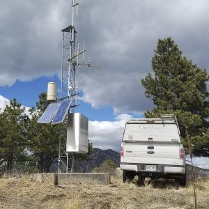
- Seamless integration of data from many sensor types and multiple source types (e.g., StormLink®, ALERT, ALERT2, Davis Instruments, Lambrecht meteo, FTS, USGS, METAR, RAWS, HADS, CDEC, Tides, GoData, RWIS, SCADA, Modbus, IoT and many more…).
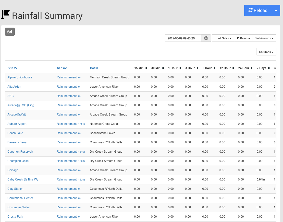
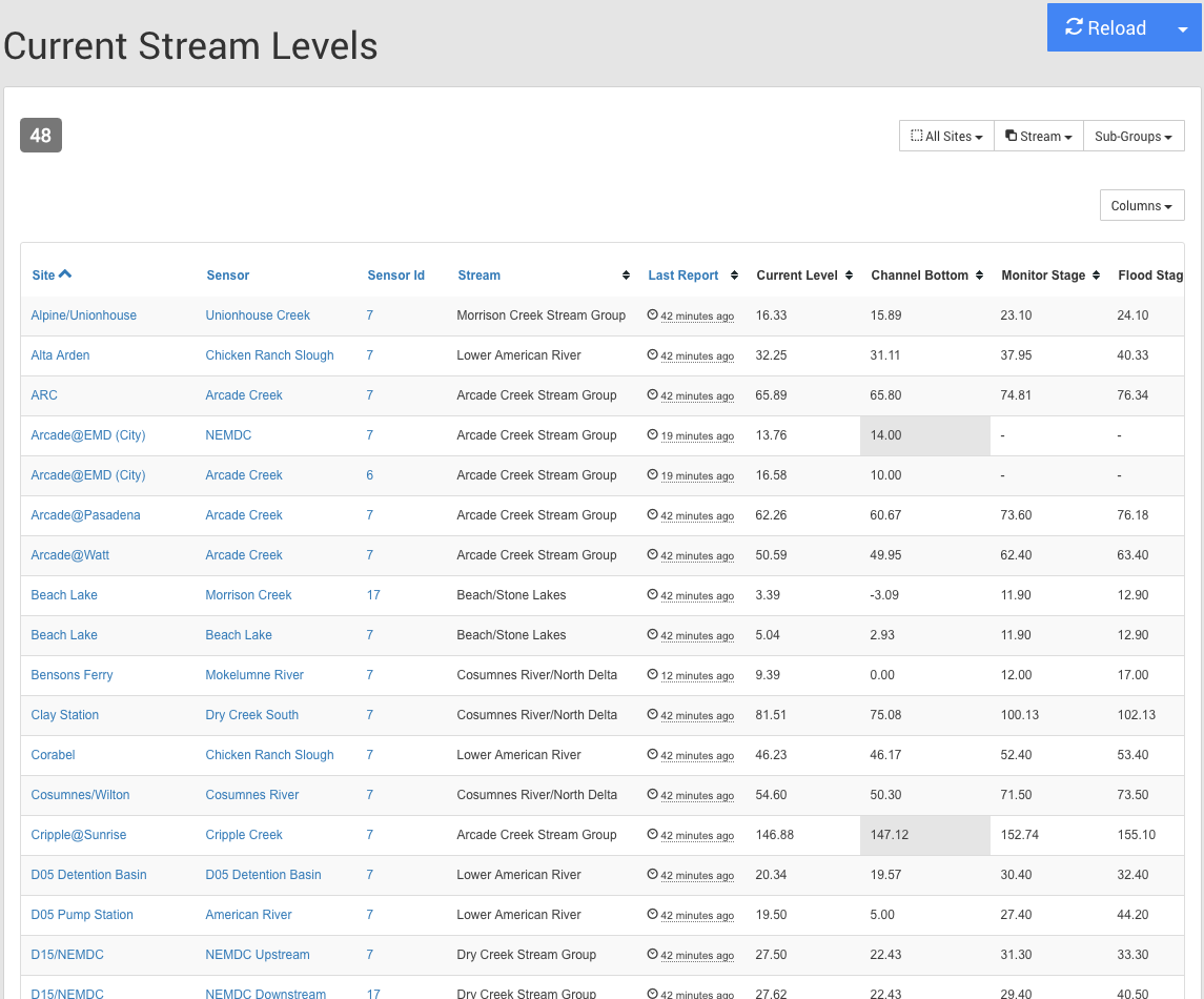
- Viewing of real-time and historical data from multiple sensor types (e.g., rain, streamflow, water level, stage, wind direction, wind speed, temperature, etc.) and sharing of data with the public.
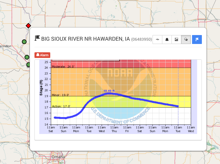
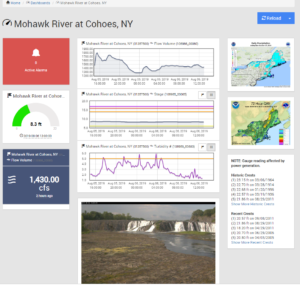
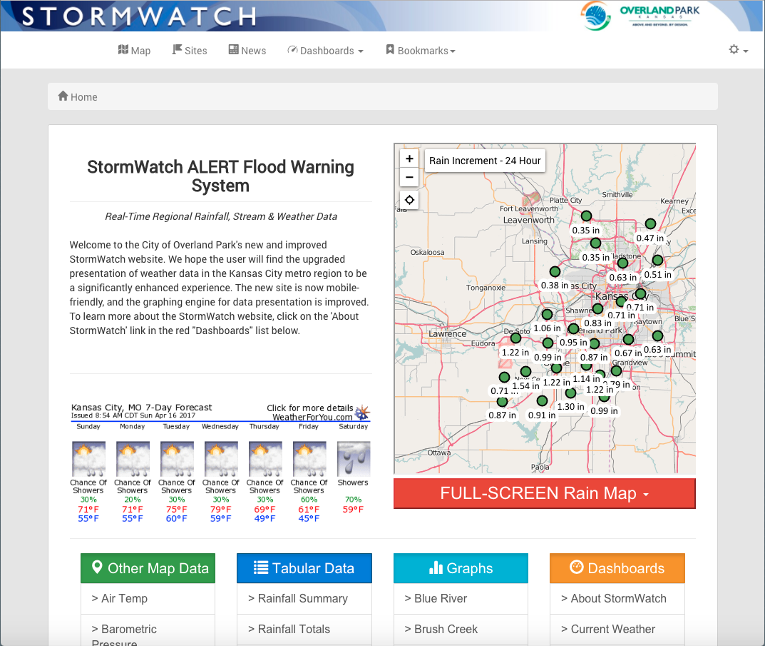
- Up-to-the-minute visualization of current conditions with data shown in easy to understand maps, real-time dashboards and widgets, charts, graphs, and tables.
- Automatic initiation of emergency notifications and automated alert messaging function based on configurable thresholds and conditions.
- Advanced Alarm Management with Boolean/Expert Equation toolset enables highly customizable user-defined alarm rules and messaging features that support decision-making criteria and EAP (emergency action plan) procedures and escalation processes.
- High-resolution, pan-and-zoom maps and custom static maps clearly locate sensors and their status, while Map Overlays allows the integration of radar, spatial rainfall, flood inundation, and GIS layers onto your custom maps.
- Advanced, integrated reporting and analysis tools. (Contrail Analytics, Contrail Inventory Plus, and Contrail ALERT2 TDMA Manager are included with both on-premise licensed Contrail Base Station and OneRain cloud-hosted Contrail Server).
Contrail software has special display screens and configurations specifically for flood warning: