While 2020 has brought many challenges and changes in the way we all work—what hasn’t changed is OneRain’s mission and commitment to the clients we serve.
Since January 2020, when OneRain first announced a major new software release and upgrade for our environmental monitoring Contrail® software suite, OneRain’s team of developers has been working hard all year to bring you a host of new features, functionality, and enhancements in our next generation Contrail® 8 platform. Upgrading to Contrail 8 was a big and important step for our customers. It means new capabilities, enhanced security, new features, add-ons, resources, and so much more.
While it’s been an unprecedented and challenging year, 2020 has been action-packed for us here at OneRain. In this article, we take a look back at the top Contrail 8 releases of 2020. And, as we look forward to 2021, we continue to be at the forefront of developing and innovating exciting new products and technologies to support the ever-changing needs of our real-time environmental monitoring clients.
Contrail® 8 Update
As of December 7, 2020, OneRain is happy to announce that all versions of Contrail running around the world have been upgraded from Contrail 6 to the latest Contrail 8 version. The upgrade sets our partner agencies up for a sustainable software environment for years to come and is included in the annual support and maintenance of Contrail. In addition to updates in security, the upgrade includes a new modern front-end framework and updated visualization that optimizes for mobile devices.
Graphing
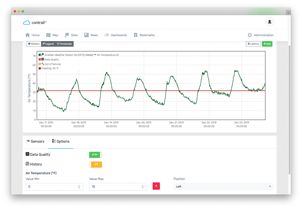
New graphing enhancements were added including historical comparison mode, data quality values, and axis configuration options. The historical comparison mode allows users to compare a time series to another while overlaid on the same graph and x axis. For example, a user could compare May 2020’s data to the previous May’s data, enabling the user to see trends in the data and respond accordingly. In addition, the user is also able to configure the axes to meet their needs, instead of defaulting to auto scaling the axes.
Map
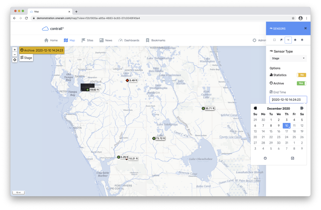
The map module also received more data-centric features, including map statics, historical data, and camera image visualization. Once a sensor has been selected, new toggles appear allowing the user to show data statistics and historical data instead of the current data values. The statics section will show the average, minimum, and maximum of the sensor data selected over selectable time ranges. For example, the user is able to quickly see important summary information for maximum water level or temperature over that time range. In addition, the user can also go into historical mode, and view data on the map from a previous date and time. This feature is great to replay an event across the area.
Alarms
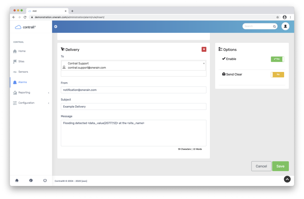
One of the most popular modules in the software also received some minor features, including the ability to send data in the alarm delivery from other sensors. Previously Contrail was only able to include data from that rule’s sensor. Now, the administrator can show current readings from other sensors that might be relevant to that alarm. Other features include the ability to copy groups and a quick reset button for alarms.
Data Formats
New data formats added in 2020 include: Earth Networks Weather Observations, Davis Instruments, FTS 360, Aeris, Lambrecht Ser[LOG], StormLink® LoRaWAN, ASCII EMIT, HOBOLink, ALERT2 Binary,and Intellisense RAFFARV5.
Data Overlays – Lightning Data
System administrators have the ability to overlay lightning, radar, and other storm-related data on the map. In addition, system administrators can add asset rings to visualize lightning relative to high-value locations. From there, rules can be written to notify contacts in the event of electrical activity in the area. We’ll be providing more information in the coming months about this new offering.
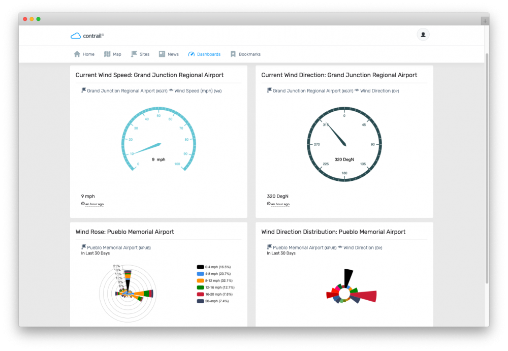
Widgets
Several new widgets for Contrail Dashboards have been added, including Wind Speed, Wind Direction, Wind Rose, Wind Direction Distribution, Contrail Camera Image browser for easily viewing previous images, Contrail Files, Google Drive and Microsoft for embedding documents, YouTube, Twitter, Earth Networks, and National Weather Service (NWS), and more.
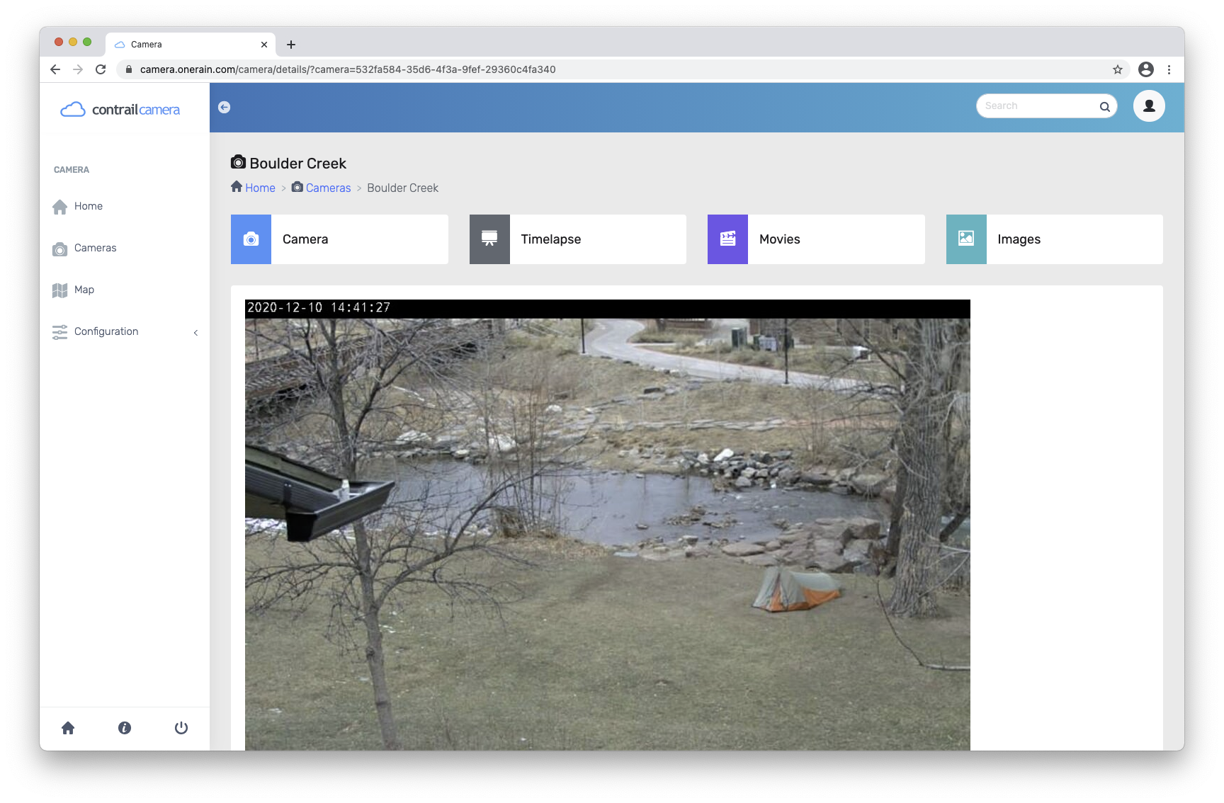
Contrail Camera
Add Rules to be notified of image latency, and more! An e-mail alert can be generated if Contrail Camera has not received an image in a predetermined amount of time. Additionally, Contrail Camera can alarm on certain image metrics of interest over particular time periods, including if duplicate images are received, a camera is over reporting, or if image data exceeds certain thresholds.
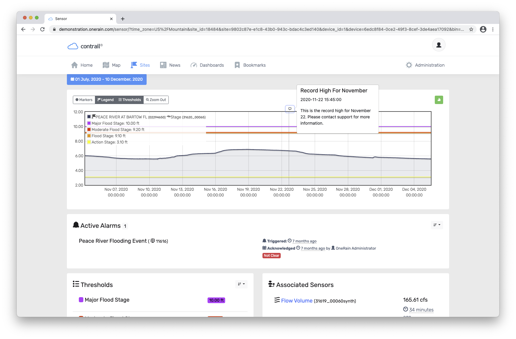
Data Annotations
Users can easily add more information within their data with data annotations. Contrail now includes annotations for documenting any additional information the system administrator would like to show: marking the start/end of a historical event, noting an instrumentation change, or indicating the beginning of a procedural change.
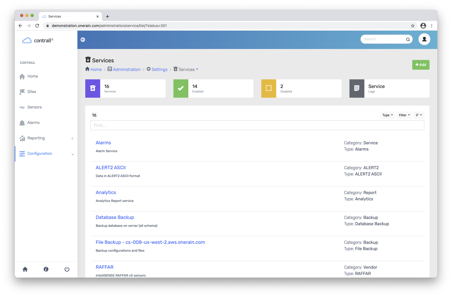
Contrail Services
New Collector and Services Manager allow for more easily configuring, including easily switching data collection and services between instances of Contrail instances for faster disaster recovery. In addition, enhanced support tools allow for the Contrail team to more easily diagnose and troubleshoot any issues with the software.
Contrail Software Localization
While the functionality of adapting the software for localization and data formats was implemented in 2019, Spanish, German, and French have now been added in as localization options in Contrail. New language support will be able to be added at any point.
Contrail Search
Improved and updated Search allows users to quickly get to the information more easily.
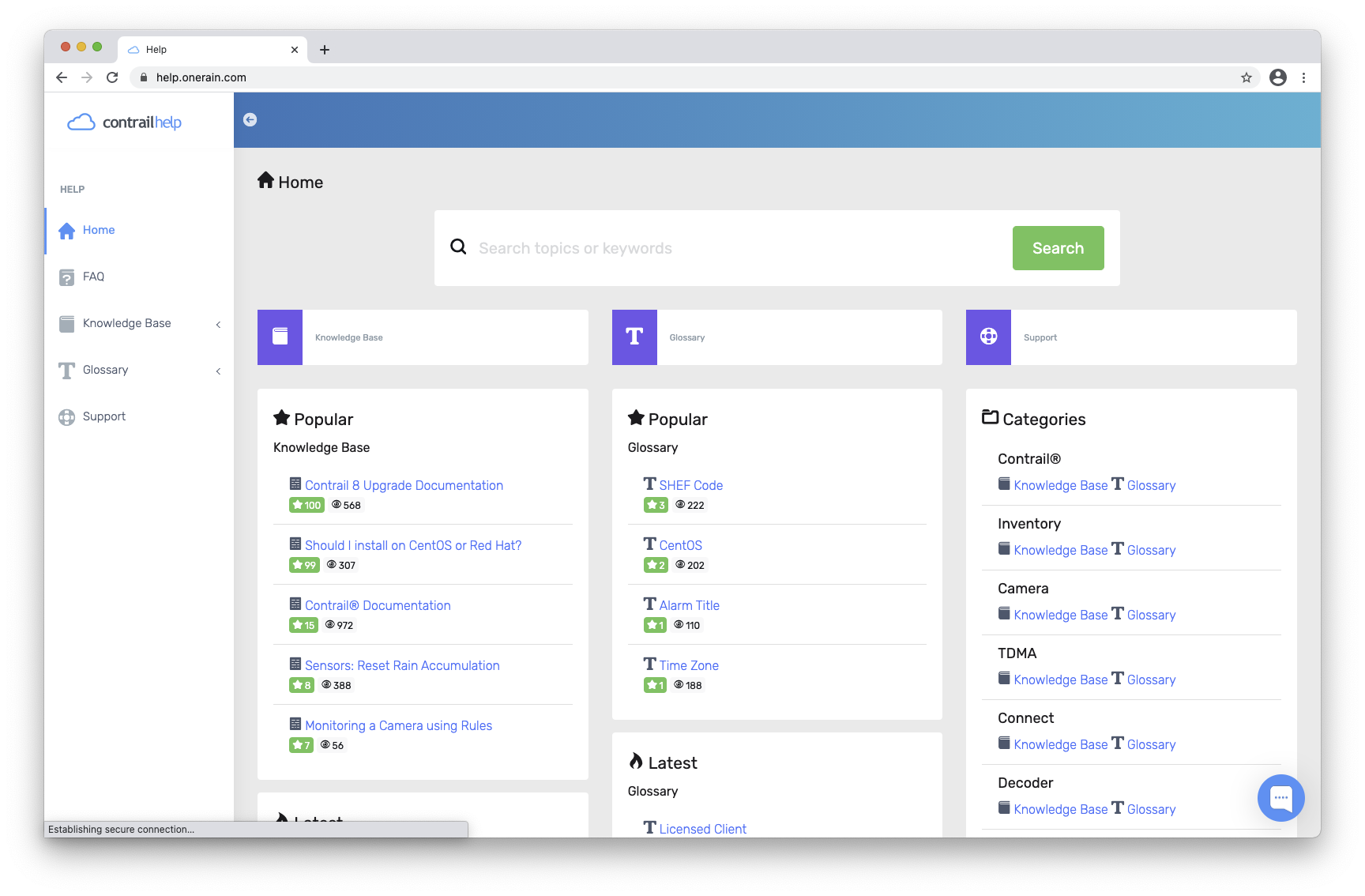
Contrail Help
An all new “Help” website has been created to make it easier to find the relevant information for general users and system administrators. The website, found at help.onerain.com, includes Knowledge Base, Articles, Glossary, FAQs, and provides the opportunity to Chat with our Contrail Support team during normal business hours.
About Contrail
Contrail is the leading enterprise-level software platform that collects, processes and delivers real-time environmental sensor data from local hydrometeorological networks and other external sources for Web-based dissemination, visualization, monitoring and automated alerting. The software provides critical information to help users understand and manage their environmental monitoring-related missions—from flood and road weather safety, to dams, stormwater, wastewater and water resource management—and is key to effective situational awareness and timely decision-making.
Sign up to keep up to date with our product announcements, training, webinars, company news and more.