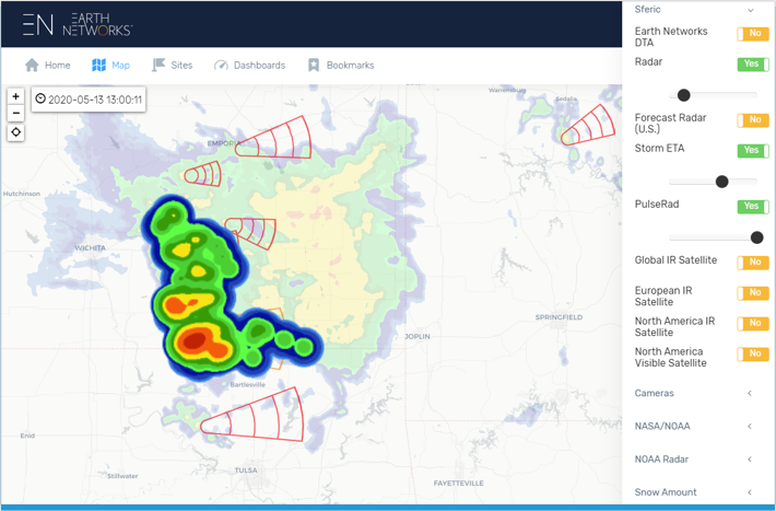
Introducing Earthquake Data Services in Contrail®

Visualize, monitor, and alert on critical seismic events in Contrail

New Earthquake Data Services in Contrail coupled with hydrologic and meteorologic data provides users with a complete view of environmental risks such as flooding and seismic hazards in one place.


The effects of seismic activity on critical infrastructure such as dams, levees, bridges, water and waste water utilities, can cause physical and functional damage, increase the risk of failure, or reduce operational performance. With increasing population growth in earthquake-prone regions as well as the vulnerability of older infrastructure, risk management best practices requires operators to promptly conduct post-event inspections and evaluation of vulnerable sites and structures.

Automate Inspection Alerts
The new fully integrated Earthquake Data Services add-on in Contrail provides users with a complete operational picture of the risks to help make informed decisions. Operators have the ability to respond promptly. Users can target specific sites of interest and create custom alerts and notifications to fit their operational needs.

HIGHLIGHTS

  • Targeted points of interest with custom Magnitude/Distance lookup table filtering
  • 24×7 monitoring with custom alarms, and notifications via sms, text, and email
  • Earthquake calculations and visualization with custom dashboards, tables, charts, and map layers
  • Documentation and archive of critical seismic events
  • Integration with EAPs (Emergency Action Plans) and other environmental data
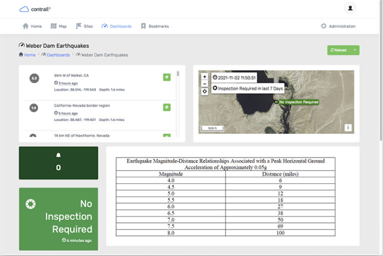
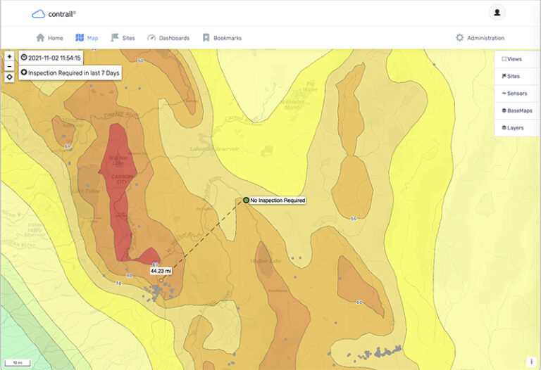
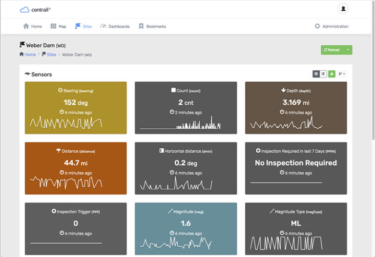
Example of a Dam Safety Program where seismic activity is monitored. Automated alerts for “Inspection Required” can be based upon specific Magnitude/Distance.

Contrail is the leading enterprise-level software platform that collects, processes and delivers real-time environmental sensor data from local hydro-meteorological networks and other external sources for Web-based dissemination, visualization, monitoring and automated alerting. The software provides critical information to help users understand and manage their environmental monitoring-related missions—from flood and road weather safety, to dams, stormwater, wastewater and water resource management—and is key to effective situational awareness and timely decision-making.

Sign up to keep up to date with our product announcements, training, webinars, company news and more.

____________________

About OneRain Incorporated

OneRain is part of AEM – a family of innovators focused on monitoring critical environmental parameters. 

Since 1992, OneRain has been providing solutions that optimize water management, heighten regulatory compliance, achieve successful civil works, and save lives. Headquartered in Longmont, Colorado, OneRain’s expertise encompasses the best environmental monitoring and water-related software and technologies, from gauging, telemetry, and remote sensing, to visualization, analysis, notification, and control. OneRain specializes in Flood Warning, Dam & Levee Safety, Reservoir Operations, Road Weather, Post-Wildfire, Irrigation and Drought Monitoring, serving local, state, and federal government agencies across the United States and around the world.
What’s New in Contrail® – October 2021

Time to get creative with your Contrail Home page with new easier content and layout tools


Explore new easy-to-use tools and new sensor equation. Here are the latest Contrail updates.

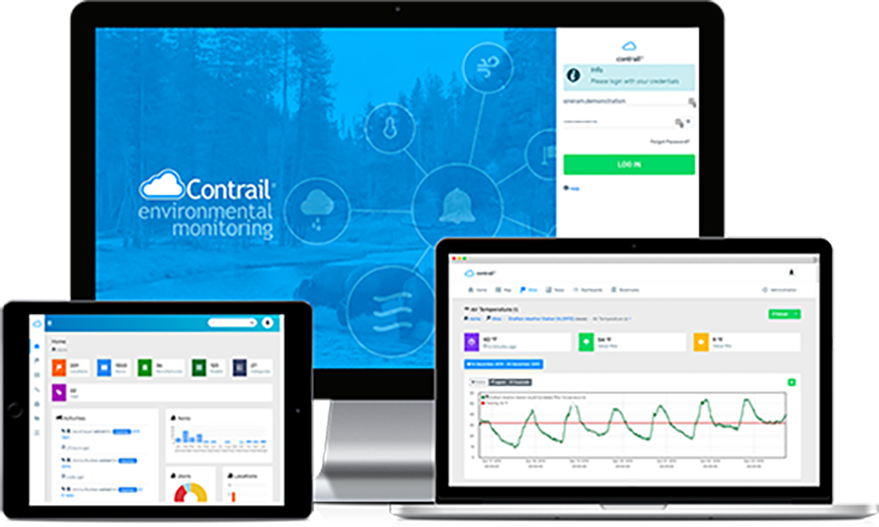
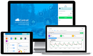
Contrail software for environmental monitoring

Easily design your Home Web page 

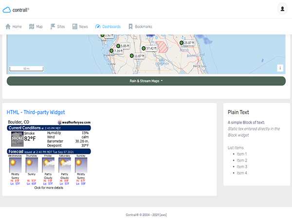
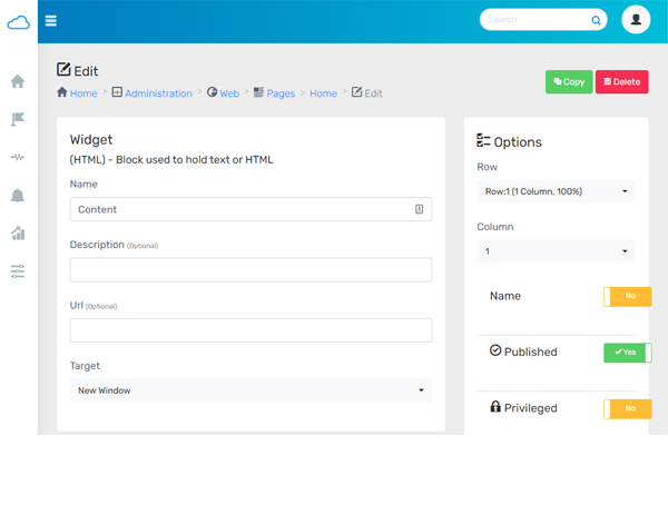
No HTML skills needed! We have introduced more user-friendly tools to help you create and visualize pages such as your Home page. Now you can use Widgets to build your layout and visual structure rather than relying on HTML.

If you have not yet used the user-friendly Widget tools to build and design your page content and layout, any existing Web page content on your site will be in an HTML Widget.

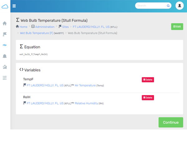
New Wet Bulb Temperature Equation Sensor

Try out the new Wet Bulb Temperature Equation Sensor.

Wet Bulb Temperature is something that can be measured! It is the the temperature measured by the wet-bulb thermometer. It can also be calculated and is is one of the factors in calculating Wet Bulb Globe Temperature (WBGT). It’s another way of quantifying the moisture in the air.

“Wet bulb temperature is the lowest temperature to which air can be cooled by the evaporation of water into the air at a constant pressure.”*

Source: ScienceDirect.com →

About Contrail

Contrail is the leading enterprise-level software platform that collects, processes and delivers real-time environmental sensor data from local hydrometeorological networks and other external sources for Web-based dissemination, visualization, monitoring and automated alerting. The software provides critical information to help users understand and manage their environmental monitoring-related missions—from flood and road weather safety, to dams, stormwater, wastewater and water resource management—and is key to effective situational awareness and timely decision-making.

Sign up to keep up to date with our product announcements, training, webinars, company news and more

OneRain is proud to be part of the AEM family of innovators.

What’s New in Contrail® – September 2021

Enhanced Contrail Dashboards, new Lightning Widgets, and more…


We’ve got lots of cool enhancements and new features to explore this month. Here are the latest Contrail updates.

Contrail software for environmental monitoring

Enhanced Layout Options for Dashboard Pages

Easily organize your Dashboard pages with improved layout and visual structure options! 

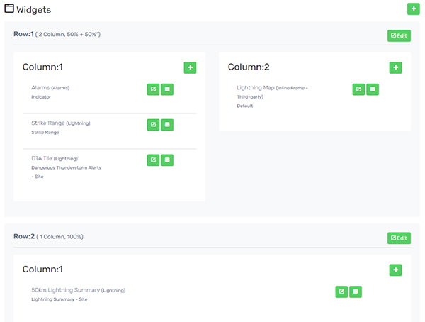
When you create a custom Dashboard page, you can now add multiple rows and select the number of columns you want in each row. Each column in a row can contain one or more Widgets. This enhancement gives you much greater flexibility to arrange and visually represent your data.

Contrail is optimized to be responsive and so all content adapts to any screen size – mobile, tablet, or desktop.

New Lightning Widget Types

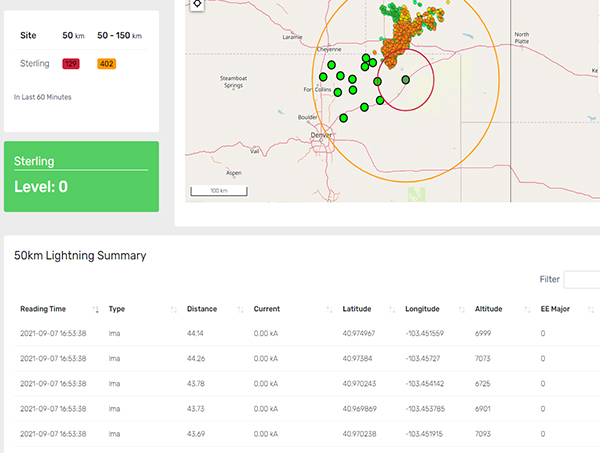
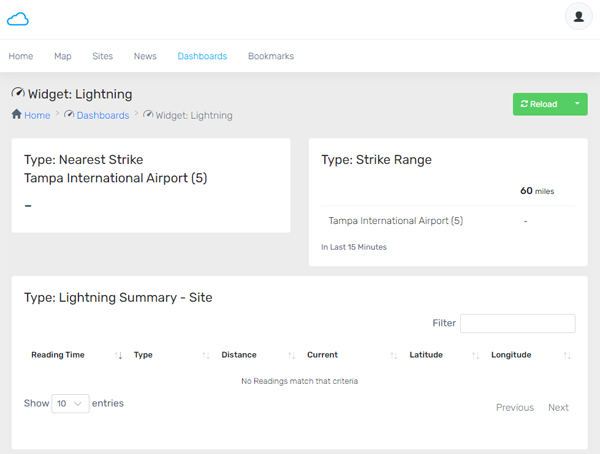
We added several new Lightning Widget Types that you can display in Dashboard pages*. They include:

– Nearest Strike
– Strike Range
– Lightning Summary – Site

*Note
This feature requires the Lightning Weather Services in Contrail® Add-on for integrated real-time lightning data in Contrail.

SEE EXAMPLE→

Password Verification

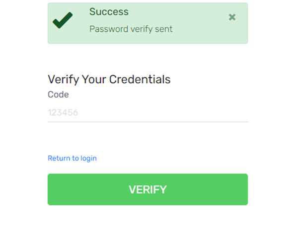
Contrail now offers two-factor authentication (2FA) through password verification. 

User Administrators can enable Password Verification for user accounts on a User-by-User basis.

Once enabled, the User will receive an email, at the address associated with their account, containing a random code to enter in order to proceed with the login.

OneRain is proud to be part of the AEM family of innovators.

About Contrail

Contrail is the leading enterprise-level software platform that collects, processes and delivers real-time environmental sensor data from local hydrometeorological networks and other external sources for Web-based dissemination, visualization, monitoring and automated alerting. The software provides critical information to help users understand and manage their environmental monitoring-related missions—from flood and road weather safety, to dams, stormwater, wastewater and water resource management—and is key to effective situational awareness and timely decision-making.

Sign up to keep up to date with our product announcements, training, webinars, company news and more

What’s New in Contrail® – August 2021

Operating system updates, new map features, equation sensor, and additional file sharing options


Our development team’s primary focus this month was on updating the operating systems that serve the critical missions of our clients. Here are the latest Contrail updates.

Contrail software for environmental monitoring

Oracle Linux 8 Updates

90%+ of our production servers, including customer deployments, are now running Oracle Linux 8 operating system for enhanced system security, optimized performance, and maintainability.

Linux is one of the most stable and robust operating systems available today where the high availability, reliability, and stability of systems is key in mission critical IT environments.

New Widget: Box

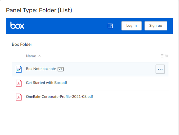
The new Box Widget enables third-party cloud content management and file sharing through the Box.com service. 

The Box Widget displays embedded shared folders from Box. You can choose different Panel options – grid, list, etc.

SEE EXAMPLE→

GeoJSON Map Layers

The GeoJSON map type is now queryable with additional styling. 

GeoJSON is an open standard format for encoding and representing a variety of geographic data structures such as simple geographical features, along with their non-spatial attributes. It is based on the JSON format. The features include points, line strings, polygons, and multi-part collections of these types.

Additional features are accessible in Contrail via Map for GeoJSON layers.

New Average Value Sensor Equation


We’ve added a new equation type: avg_value() sensor equation

An example use case might be if you are looking for the “average temperature over 15 minutes”.

OneRain is proud to be part of the AEM family of innovators.

About Contrail

Contrail is the leading enterprise-level software platform that collects, processes and delivers real-time environmental sensor data from local hydrometeorological networks and other external sources for Web-based dissemination, visualization, monitoring and automated alerting. The software provides critical information to help users understand and manage their environmental monitoring-related missions—from flood and road weather safety, to dams, stormwater, wastewater and water resource management—and is key to effective situational awareness and timely decision-making.

Sign up to keep up to date with our product announcements, training, webinars, company news and more

What’s New in Contrail® – July 2021

More data sources, integrations, and feature enhancements. 


It keeps getting better. See what the Contrail® development team has been up to this month.

Contrail software for environmental monitoring
Contrail integration with AEM family of products

Expanded Family of Integrations

Contrail fully supports integration with our AEM family of compatible dataloggers and software products.

Tile Widget Enhancements


Everybody loves Contrail Widgets. Now you can customize how they display:

Widget sensor toggle
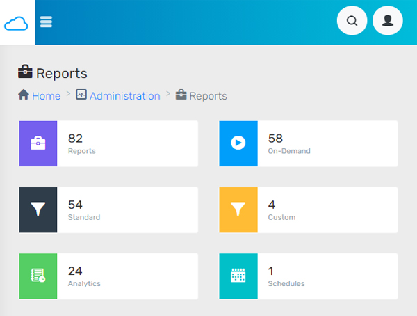
Contrail Reports

Reports – Scheduled Query


Now you can create a Scheduled Query with a recurrence interval of every day, week or month. Choose the day, time, and who you’d like to receive the results.  

Lightning Weather Services Map Layer Animation


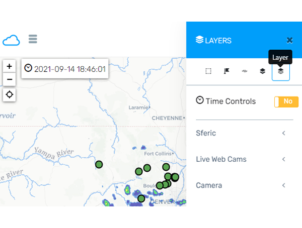
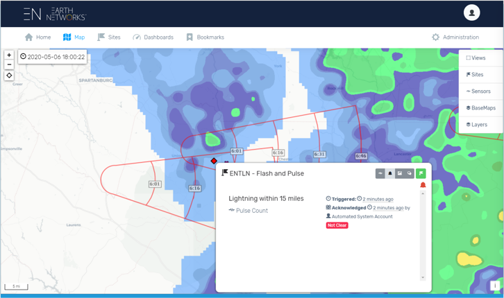
The ENTLN Map Layer animation can now be time-controlled. 

Lightning Weather Services in Contrail add-on provides integrated-real-time lightning data powered by Earth Networks Total Lightning Network.

Lightning weather services in Contrail

OneRain is proud to be part of the AEM family of innovators.

About Contrail

Contrail is the leading enterprise-level software platform that collects, processes and delivers real-time environmental sensor data from local hydrometeorological networks and other external sources for Web-based dissemination, visualization, monitoring and automated alerting. The software provides critical information to help users understand and manage their environmental monitoring-related missions—from flood and road weather safety, to dams, stormwater, wastewater and water resource management—and is key to effective situational awareness and timely decision-making.

Sign up to keep up to date with our product announcements, training, webinars, company news and more

What’s New in Contrail® – June 2021

We’re always working behind the scenes.


See what’s new from the Contrail® development team this month. Even when you can’t see the changes, we’re constantly working to optimize the processes that keep your services running at their most efficient.

Contrail software for environmental monitoring
Contrail Data Agents

Additional Data Sources

 
Introducing New Data Agents and Data Collectors
  • Aquarius System: The Aquarius agent in Contrail collects real-time data from Aquarius WebPortal through an agency’s Aquarius API. An account with your agency’s Aquarius WebPortal is required to utilize this System Type.
  • HOBOlink System: The HOBOlink agent in Contrail collects real-time data your Onset HOBOlink stations via the Onset HOBOlink website at www.hobolink.com.
  • Aeris System: Retrieve data via AerisWeather (a 3rd-party paid service). The Aeris agent in Contrail collects real-time data from AerisWeather via https://www.aerisweather.com. A user account through the AerisWeather site is required in order to use this System Type.
  • IntelliSense System: The IntelliSense Data Collector pushes data to Contrail. Requires a port, IP and networking.

Behind the Scenes – Data Manager Service

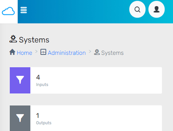
We introduced a new Data Manager Service that runs in the background to more efficiently assist with deletes, copies, and other data-heavy processes.

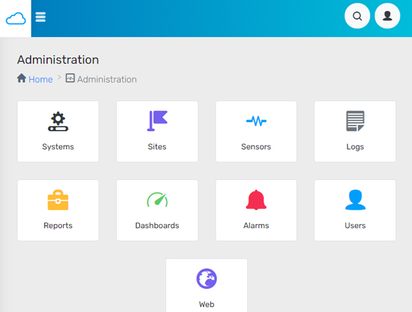
Contrail Administration Panel

OneRain is proud to be part of the AEM family of innovators.

About Contrail

Contrail is the leading enterprise-level software platform that collects, processes and delivers real-time environmental sensor data from local hydrometeorological networks and other external sources for Web-based dissemination, visualization, monitoring and automated alerting. The software provides critical information to help users understand and manage their environmental monitoring-related missions—from flood and road weather safety, to dams, stormwater, wastewater and water resource management—and is key to effective situational awareness and timely decision-making.

Sign up to keep up to date with our product announcements, training, webinars, company news and more

What’s New in Contrail® – May 2021

Check out the latest software updates and enhancements in Contrail.


We introduced cool new Map layers, new Alarm function, and made it easier to get to information from our other Contrail applications.

Contrail software for environmental monitoring

Additional Map Sources

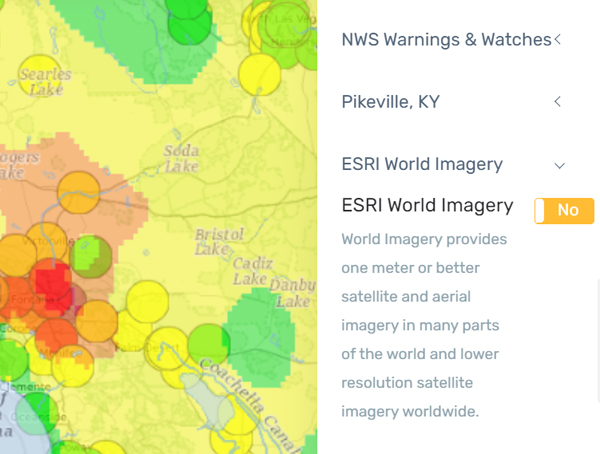
Feature Server Map Types are now supported in Contrail. Feature Servers allow for a more robust and data rich integration into Contrail. This new map type integration allows for more compatibility with GIS servers and data formats within your organization. As more and more GIS data formats are being delivered via Feature Servers, this integration ensures that your data will continue to work into the future.

Additional Map sources now include ESRI ArcGIS Feature Server Map.

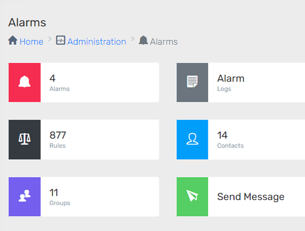
New Alarm Function for Invalid Data Records

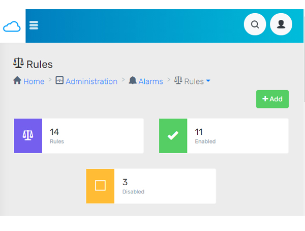
Contrail Administrators can now create alarms, and receive alert notifications if desired, for invalid data records. The new alarm function:

number_of_invalid_reports(MINUTES)

returns the number of invalid reports for a Sensor over a time interval, in minutes.

Contrail Alarm Function

Contrail Cross-application Integration


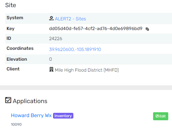
Quickly access information from other Contrail applications. Now you can easily get to Contrail Inventory Plus, Contrail TDMA Manager, and Contrail Camera with links at Sites and Sensors.

In the example shown under “Applications”, selecting the name opens up the Contrail Inventory Plus application to the page associated with that site. 

About Contrail

Contrail is the leading enterprise-level software platform that collects, processes and delivers real-time environmental sensor data from local hydrometeorological networks and other external sources for Web-based dissemination, visualization, monitoring and automated alerting. The software provides critical information to help users understand and manage their environmental monitoring-related missions—from flood and road weather safety, to dams, stormwater, wastewater and water resource management—and is key to effective situational awareness and timely decision-making.

Sign up to keep up to date with our product announcements, training, webinars, company news and more

OneRain is proud to be part of the AEM family of innovators.

What’s New in Contrail® – April 2021

What’s New? A New View: Cameras, Image Collection, and Artificial Intelligence


This month we introduced lots of new and innovative features in Contrail® Camera. Environmental hazards present a unique challenge to decision makers as they not only must confirm the conditions as quickly as possible, but as accurately as possible. Contrail Camera creates a more complete view of conditions for complete situational awareness.

Contrail software for environmental monitoring
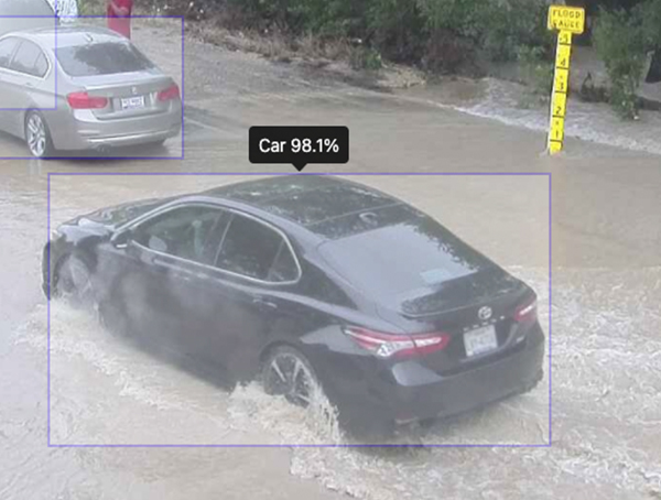
Contrail Camera Vision License enable AI-detection and alerting

Contrail Camera – Vision License

The newest functionality: utilizing machine learning object detection to analyze images and alert on predefined criteria, allows for a complete view of both your data and your field-generated images. With the Vision license, users can turn on a machine learning model that has predefined tags for each camera location. The system will then detect objects in each image, including person, cars, trucks, etc. Contrail Enterprise users can create custom Alerts and Notifications based on AI-detected objects. These capabilities are incredibly useful for camera applications where you need to know if a car has driven into a flooded roadway, or a person is walking on a dam where they shouldn’t be, for example.

New Contrail Camera Widgets

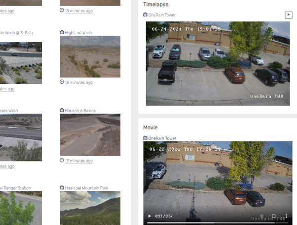
We added two new Contrail Camera Widgets that bring additional  integrated functionality into Contrail Enterprise:

– Contrail Camera Timelapse Widget
– Contrail Camera Movie Widget

Administrators can select Timelapse period – e.g., 2 hours, 4 hours, up to 24 hours. For the Movie Widget, select the latest daily, for example. You can easily create Dashboards in Contrail to display these Widgets next to your Site and Sensor data.  

SEE EXAMPLE→

About Contrail

Contrail is the leading enterprise-level software platform that collects, processes and delivers real-time environmental sensor data from local hydrometeorological networks and other external sources for Web-based dissemination, visualization, monitoring and automated alerting. The software provides critical information to help users understand and manage their environmental monitoring-related missions—from flood and road weather safety, to dams, stormwater, wastewater and water resource management—and is key to effective situational awareness and timely decision-making.

Sign up to keep up to date with our product announcements, training, webinars, company news and more

What’s New in Contrail® – March 2021

Our Team has been very busy working behind the scenes.


This month we introduced some new Widgets that allow for advanced views of sensor data to complete your decision support needs. Try them out!

Contrail software for environmental monitoring
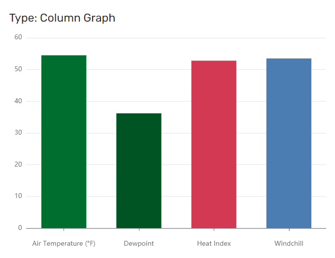
Contrail Column Graph Widget

Column Graph and Bar Chart Widgets


New Column Graphs (shown left) and Bar Chart Widgets allows you to quickly compare totals across multiple Sensors or Sites. 

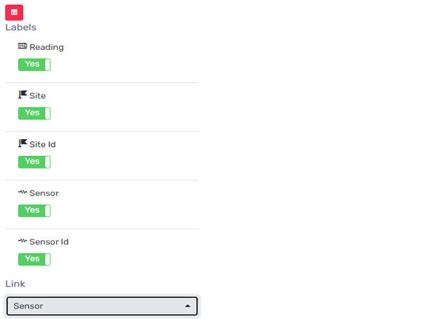
You can set the min and max scale and selectively turn on the Site and Sensor labels. Additional range coloring capabilities are also available.

SEE EXAMPLES →

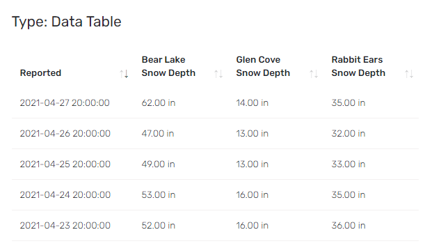
Data Table Widget


The Data Table widget is ideal for time series data and allows you to look at multiple sensors on the same Table Widget. Some examples might be where you want look at all the water level totals in a watershed, or all of the sensor reports at a weather station. The data table will automatically make a row for each report and combine reports with the same date and time stamp.


SEE EXAMPLE→

Contrail Table Widget

Advanced Multi-graph Widgets


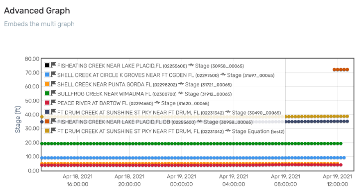
Now you can embed advanced Multi-graph Widgets within Contrail Dashboards. Get a combined view of multiple sites natively within a Dashboard.


SEE EXAMPLE→

About Contrail

Contrail is the leading enterprise-level software platform that collects, processes and delivers real-time environmental sensor data from local hydrometeorological networks and other external sources for Web-based dissemination, visualization, monitoring and automated alerting. The software provides critical information to help users understand and manage their environmental monitoring-related missions—from flood and road weather safety, to dams, stormwater, wastewater and water resource management—and is key to effective situational awareness and timely decision-making.

Sign up to keep up to date with our product announcements, training, webinars, company news and more

What’s New in Contrail® – February 2021

Here’s a summary of just some of the latest software updates and enhancements in Contrail that we thought you’d like to hear about.

Contrail software for environmental monitoring
Davis WeatherLink Sensors in Contrail

New Data Agent: Davis Instruments WeatherLink


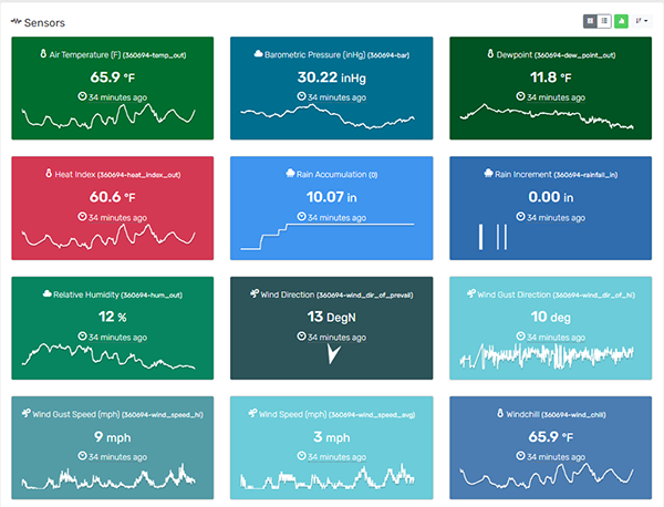
Got Davis Weather Stations in your region? Whether you own a Davis Weather Station or know of other Stations in your area, you can now bring in data, display, and alarm on Davis sensors in Contrail. Contact us for more information.


SEE EXAMPLE â†’

New Map Widget


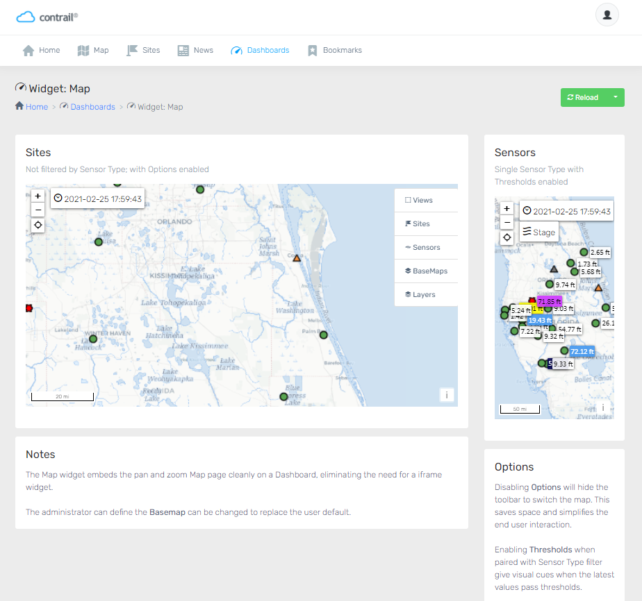
A new easy option when you’re building Dashboards in Contrail. The Map widget embeds the pan and zoom Map page cleanly on a Dashboard, eliminating the need for a iframe widget. Administrators can choose and control which Basemap should be displayed so that it replaces the user’s default.


SEE EXAMPLE →

Integration with High Sierra Electronics’ new Remote Erosion Monitoring System


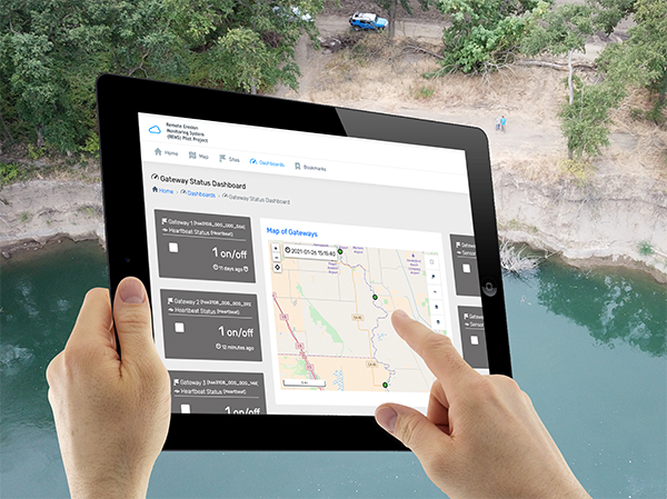
Just launched! Contrail is the data collection and monitoring platform for High Sierra Electronics’ new Remote Erosion Monitoring System (REMS) for earthen levees and dams.


READ MORE →

New Add-on: Lightning Weather Services

Now you can complete your severe weather picture! This new add-on module in Contrail enables multi-hazard alerts, lightning map layers, table and graph data displays, dangerous lightning storm indicators, and more, with integrated lightning data from Earth Networks.


PRODUCT INFO →

OneRain is proud to be part of the AEM family of innovators.

About Contrail

Contrail is the leading enterprise-level software platform that collects, processes and delivers real-time environmental sensor data from local hydrometeorological networks and other external sources for Web-based dissemination, visualization, monitoring and automated alerting. The software provides critical information to help users understand and manage their environmental monitoring-related missions—from flood and road weather safety, to dams, stormwater, wastewater and water resource management—and is key to effective situational awareness and timely decision-making.

Sign up to keep up to date with our product announcements, training, webinars, company news and more